We are looking for volunteers to walk sections of path and look out for patches of sphagnum.
We’d like you to tell us whether you saw any sphagnum or not and if you did, some information about the patches you saw.

The Big Moss Map
The Big Moss Map is a survey of sphagnum moss in the Peak District and South Pennines. By surveying sphagnum over many years, we will be able to detect whether we are seeing any changes in how much Sphagnum there is and the types of places it is growing in - information which will help us in our efforts to conserve blanket bog habitat.
Why survey sphagnum mosses?
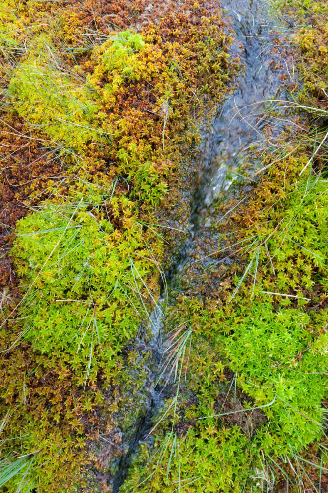
Sphagnum mosses are hugely important in the uplands due to the unique environments these plants help to create. As sphagnum plants grow upwards, the lower parts of the plant die but do not decompose very quickly if the ground is waterlogged.
This leads to the accumulation of organic material, or peat. This can take place over many thousands of years, with peat becoming several metres deep. Healthy peatlands have many benefits - from supporting wildlife communities and locking up atmospheric carbon to reducing flood risk and improving water quality.
Unfortunately, many peat bogs - especially in our project area - have become damaged over time because of the effects of air pollution; because peat has been harvested for fuel or for compost; and because land has been dried out through drainage and wildfire.
A lot of work has gone into restoring these degraded peatlands, and the Moors for the Future Partnership are playing an important role in re-introducing sphagnum to the region. However these mosses now face a new threat from climate change. They are particularly at risk because they suffer damage if they are exposed to temperatures higher than 15°C - and summer temperatures are projected to increase in the future; added to this peat only forms when bogs are saturated - and rainfall patterns are also projected to alter in the future.
We, therefore, want your help to map where sphagnum mosses are found in our project area. By doing this over many years, we will be able to detect whether we are seeing any changes in how much sphagnum there is and the types of places it is growing in. Your information will help inform future conservation efforts to protect these plants and the habitats they are associated with.

Get involved
To get involved in The Big Moss Map you simply need to walk any right-of-way in or near our project area, covering the South Pennines Special Area of Conservation (SAC) and the Peak District National Park (see map below) and record whether or not there was any Sphagnum present at either side of the path. It is very helpful to take photos of any sphagnum patches you see so they can be verified by experts and also so that we can see if they change in size in years to come.
How to take part
1. Choose where you will survey.
We've split our project area up into 55 smaller survey areas which are shown on the map below. For each of these areas we've produced a map with rights of way marked. Download a map of the area using the links in the table. You can check which paths have already been surveyed by logging in to our iRecord page and viewing our map of Sphagnum presence. Please note, you'll need to set up and be logged into an iRecord account to access this page if you don't already have one.
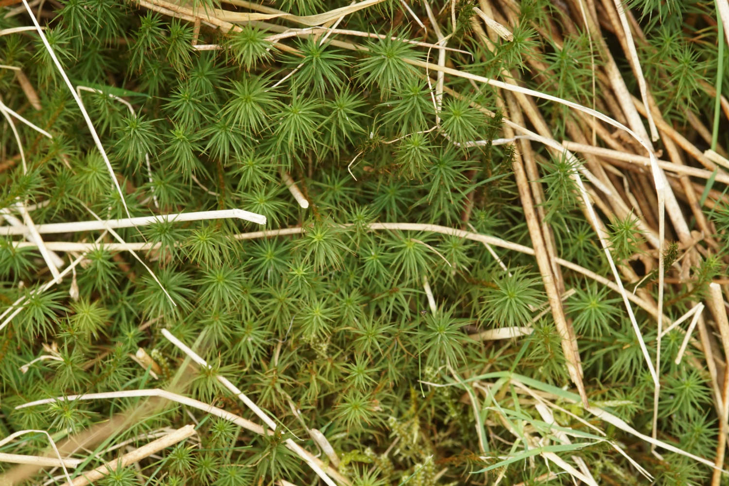
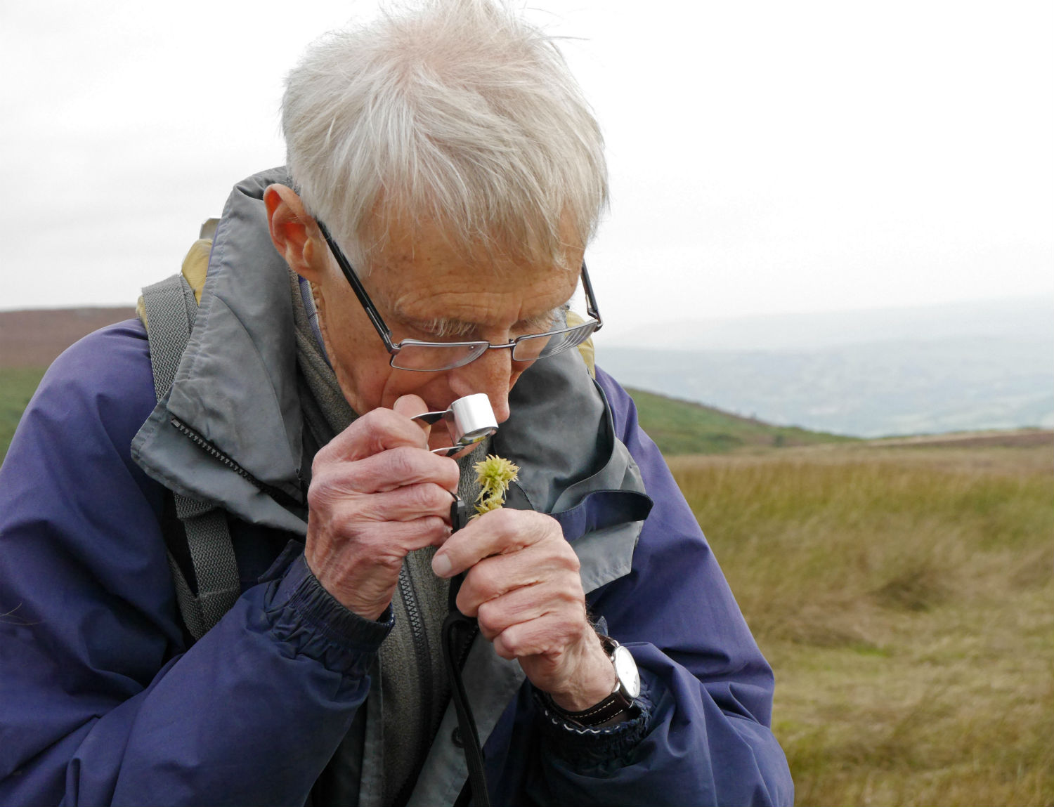
2. Make sure you can tell sphagnum from other mosses
Make sure you can tell sphagnum apart from other mosses. Check our Sphagnum ID guidance below for identification resources and links.
3. Gather the things you will need to take with you on your survey
Download a survey guide which will tell you how to conduct the survey and the information you need to collect, and a recording form to take out with you on your survey. Download a habitats guide.
If you have one, we recommend you take a GPS unit or a smartphone with a GPS app to accurately record the location of sphagnum patches.
You will also need to take a map of the survey area with you to help you find your survey location and to record the locations of any sphagnum patches you see. This could be a satellite image, for example from Google Maps, or a paper copy of an Ordnance Survey map. Take a camera if you have one for photographing any sphagnum patches you find.
4. Carry out your survey
Walk along your chosen path and fill in your recording form as you go. This webpage should contain all the information you need to get started, but if you need some extra help please contact us and we can pair you up with an existing volunteer who can provide survey training.
5. Submit your results using our iRecord portal
Please do this whether or not you saw any sphagnum patches - it is vital to know where sphagnum isn't found as well as where it is! Full information for submitting results can be found at the bottom of this page. If you need help using iRecord you can download our guidance.
Please note: While carrying out this survey you do so entirely at your own risk. Moors for the Future do not accept any liability or responsibility for the well-being of surveyors or damage/loss of their property. Download our Health and Safety Guidelines here.
Where to survey
We have divided our project area into 55 smaller survey areas. Please click on the overview map below to see a larger version, and consult the table below to download the map of your chosen area, which displays public rights of way.
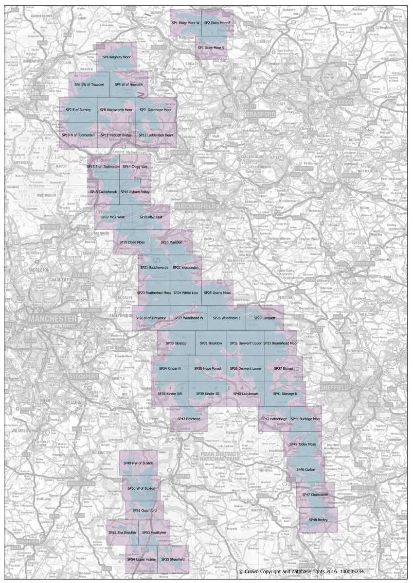
Use the links in the table below to download a PDF map of your chosen survey area:
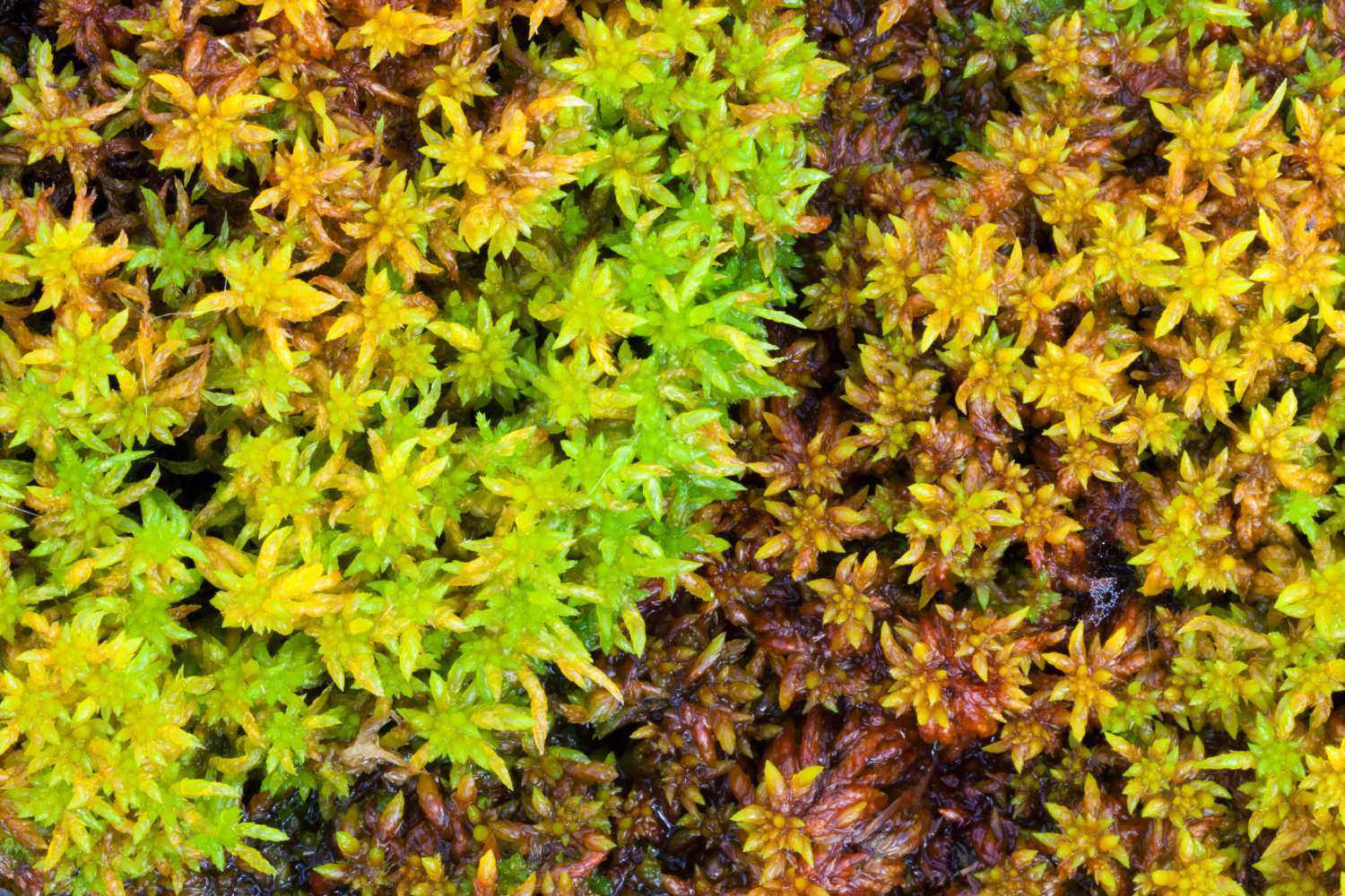
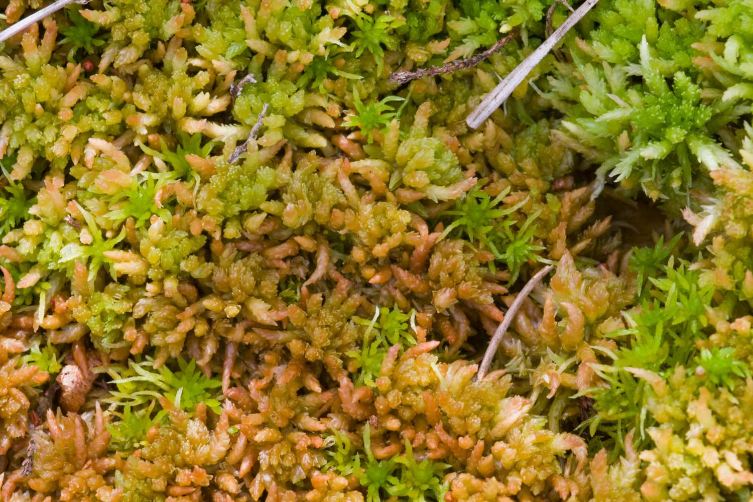
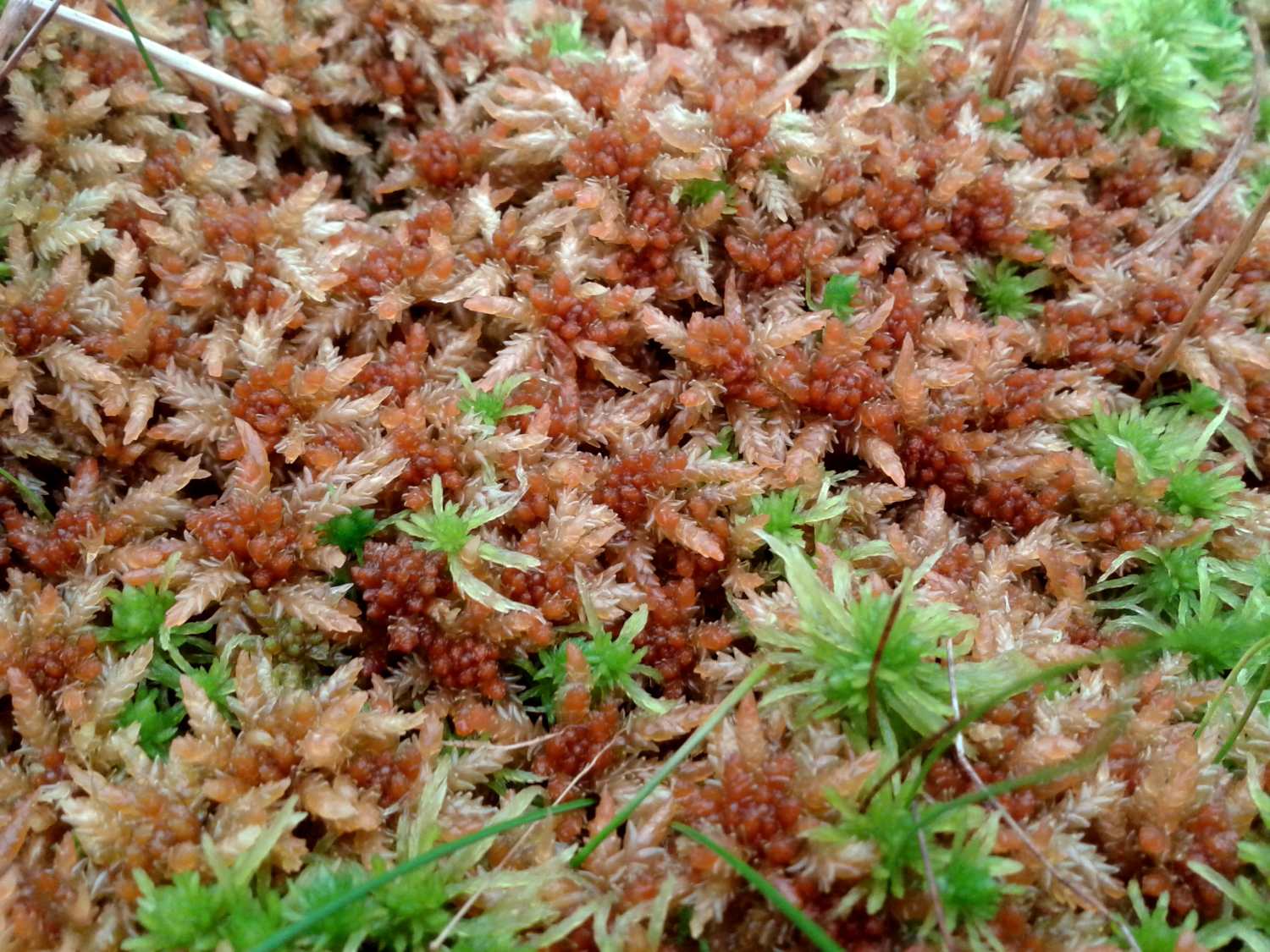
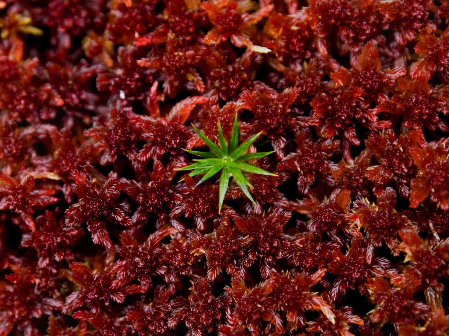
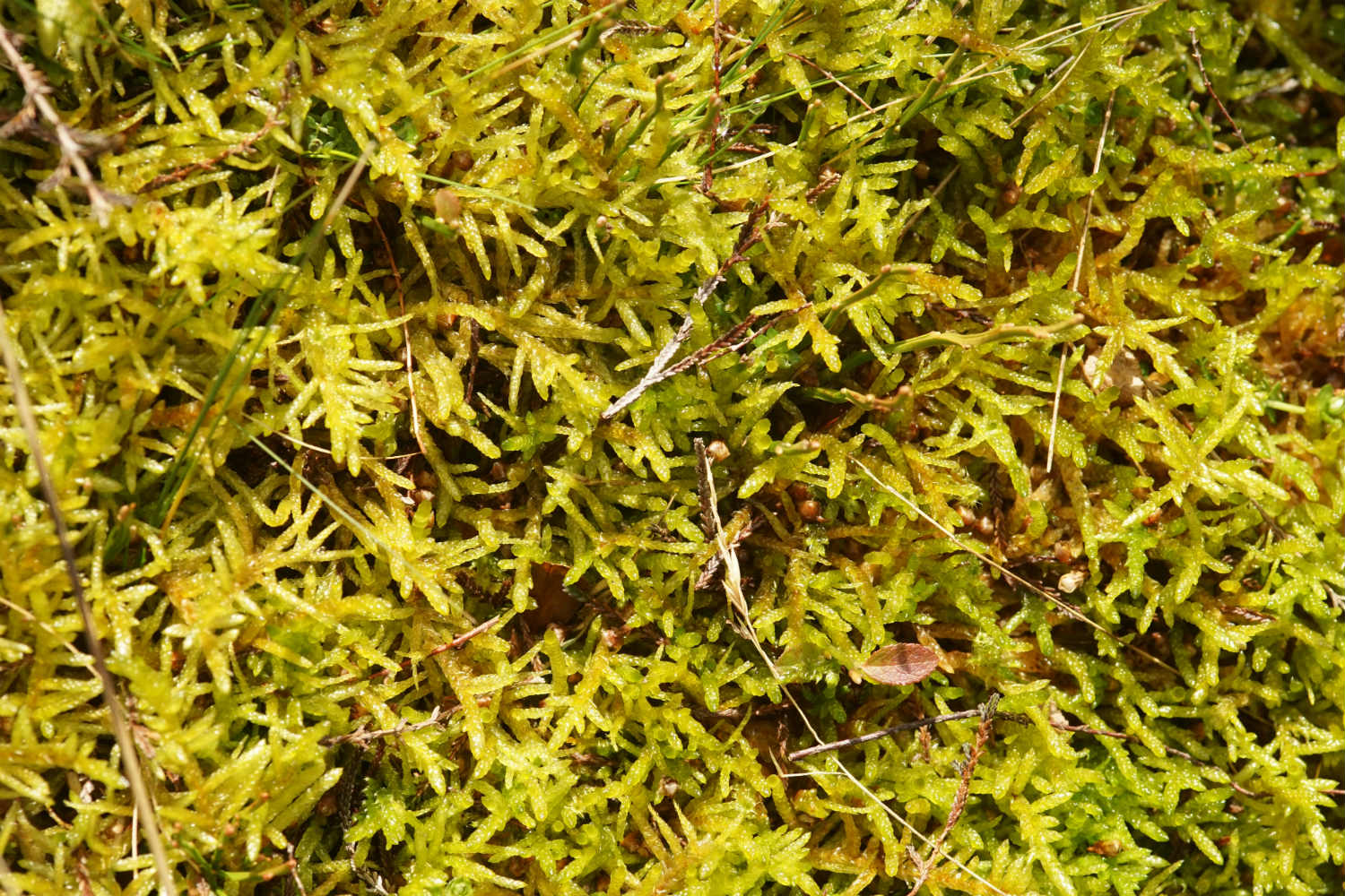
Sphagnum identification
Before taking part in the survey it is important that you know what sphagnum mosses look like, and that you can tell them apart from other mosses. Knowing how to identify individual species of sphagnum is not essential to the survey, but there is an option to record your sightings in this detail if you wish.

External Links
The British Bryological society has free to download guides, covering every species of British Sphagnum; taken from the book "Mosses and Liverworts of Britain and Ireland: A Field Guide" by Atherton, Bosanquet and Llawley.
UKEconet Training Guide for Sphagnum Mosses - for beginner, intermediate and advanced.
Field Studies Council: Buy the FSC laminate guide "Sphagnum mosses in bogs" here.
The British Bryological Society has a wealth of information about mosses, liverworts and hornworts, including species guides and details of training.
iSpot: Community where you can upload your photos for identification and help ID other people's pictures.
JNCC: A more detailed key to identifying Sphagnum species can be found here.
How to submit your results
When you have finished a sphagnum survey you should submit your results to 'The Big Moss Map' online or by post using the instructions below.
Online
Login to iRecord then... Submit your records via the Moors for the Future iRecord page.
Select 'Enter a Sphagnum Survey' and follow the instructions on screen.
Please note: the first time you use the site you will need create a new account by visiting http://www.brc.ac.uk/irecord/user/register. Once you have created an account make sure you are logged in, otherwise you will see an 'Access Denied' message.
You can submit results from a survey where you recorded the route you walked along, but also submit 'random patches' (casual records) of sphagnum which we're associated with a survey.
If you need any help submitting your results please download the guidance document.
By Post
If you have completed a sphagnum survey and would like to post your survey results in to us please send your completed recording sheet(s) to:
Community Science Project
Moors for the Future Partnership
The Moorland Centre
Edale
Derbyshire
S33 7ZA
You can also scan and e-mail your completed recording form to us at moorcitizens@peakdistrict.gov.uk
Privacy information:
The information submitted using this form will be added to the relevant Moors for the Future survey database held by the Biological Record Centre. Your contact information may be shared with verifiers who will only contact you if they have a query about the data you have submitted. The biological record, excluding your name and email address, will be publicly visible and may be shared with other conservation organisations and databases. If you have opted in to join our mailing list you will receive updates by e-mail about the partnership and our projects. Your information will be held securely by Moors for the Future Partnership and will not be shared with any third parties. You can opt-out of receiving information at any time using the link in the footer of our communications. You can find out more about how we use your information from our Privacy Notice which is available on our website at http://www.peakdistrict.gov.uk/looking-after/about-us/privacy-policy
Citizen Science Wildlife Surveys
Take a look at all of the animals and plants you can record to help us monitor the impact of climate change in moorland environments