
Measuring the impact of our conservation work
We are monitoring the impact of our conservation work to evaluate its effects and determine whether we are achieving our aims. We’re measuring the effects of the work on a variety of outcomes. Our aim is to see benefits to local communities (plant diversity, water quality, flood risk mitigation) as well as to wider global concerns (carbon balance and climate change).
Multiple benefits
These beneficial effects, known as ecosystem services, are being monitored on four experimental sites across the Peak District and South Pennines SAC.
The work provides a learning opportunity, enabling us to establish and share evidence-based land management best practice with other land managers and conservationists.
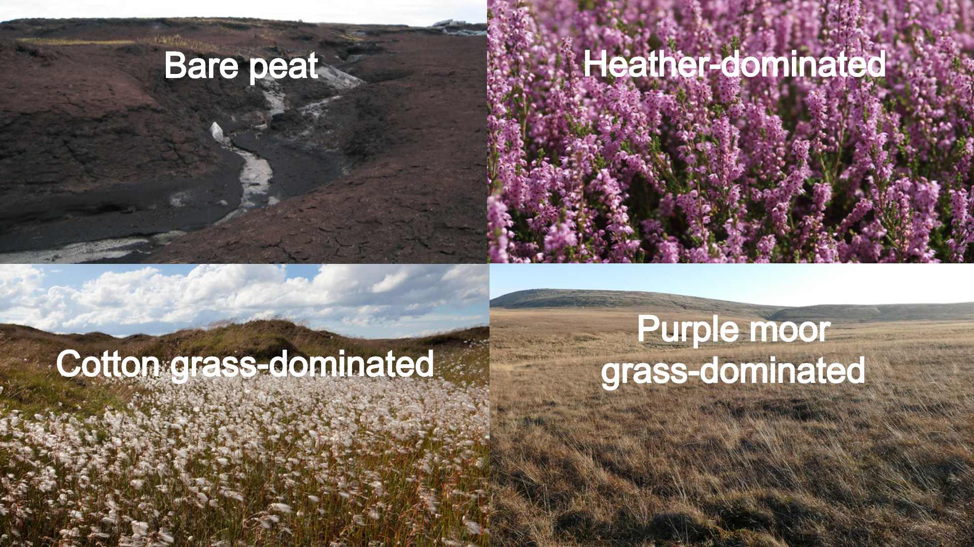
The four demonstration sites are all classified as ‘degraded’ blanket bog habitat. Each has a different starting state:
- bare peat
- heather-dominated
- cotton grass-dominated
- purple moor grass-dominated
Research sites
Work on the three sites that are dominated by a single species of vegetation mainly involves planting sphagnum moss to diversify the mix of vegetation. On the heather-dominated site we are also investigating the further impact which gully blocking has when combined with vegetation diversification.
Monitoring of these benefits on each of the sites occurs in control and treatment mini-catchments (each one is roughly the same size as a football pitch) before and after, the conservation work is carried out. This lets us look at the natural differences between the mini-catchments before conservation work takes place so that we can tell exactly what impact our conservation work has. We measure changes to the following outcomes:
- plant diversity: monitoring changes in the plant community using permanently fixed 2 x 2m square quadrats, and annual surveys.
- water quality: analysing water samples from each site every month to monitor changes in colour and dissolved carbon compounds.
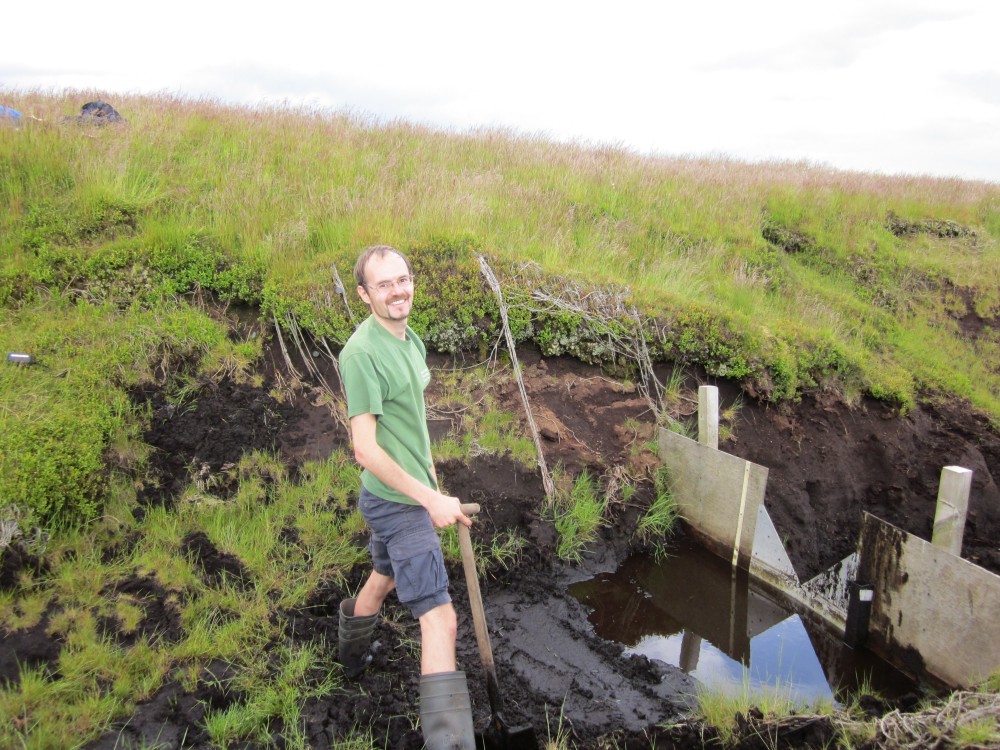
- flood risk mitigation: monitoring water flow using v-notch weirs, gauging stations and automated data loggers.
- water tables: monitoring water table levels using dipwells installed at each site. Dipwells are small wells to measure how far the ground water is from the surface.
- carbon accumulation behind gully/grip blocks: Using sediment traps to measure how much carbon (organic matter) builds up over time.
Monitoring biodiversity and ecosystem services at these four field laboratories helps us to evaluate the effects of our work and determine whether we are achieving our aims. It also provides a learning opportunity enabling us to establish and share evidence-based land management best practice with other land managers and conservationists.
Reports:
A report into the impacts cutting cotton grass has on the growth rate of sphagnum moss
Ecosystem Service Impacts of Degraded Blanket Bog: A Report Summary
Ecosystem Service Impacts of Degraded Blanket Bog: An Introduction
Ecosystem Service Impacts of Degraded Blanket Bog: Vegetation Diversity
Ecosystem Service Impacts of Degraded Blanket Bog: Stream Discharge
Ecosystem Service Impacts of Degraded Blanket Bog: Water Chemistry
Ecosystem Service Impacts of Degraded Blanket Bog: Sedimentation Generation and Transport
Conservation work
Conservation work on the bare peat site is complex, involving stabilisation, nutrient enrichment, seeding, liming and planting plugs that contain 12 different species of sphagnum moss
Funded by
![]()
![]()