An interactive map showing 17 years of moorland restoration is now available to view.
The Moor Mapping Project was commissioned by Natural England to provide an online map of all of upland restoration carried out in the Peak District National Park since 2003.
The map is based on data from Moors for the Future Partnership’s work, as well as from other partners and stakeholders, who have kindly contributed data for use in this project.
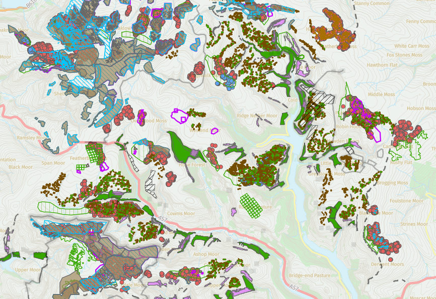
The map shows a patchwork of interventions, from the use of mini-dams to restore hydrology (rewet) areas of blanket peat, to seed spreading and planting sphagnum and dwarf shrubs. The aim of all these actions is to improve the condition of damaged peatlands for a suite of reasons, including reducing greenhouse gas emissions, improving habitat and biodiversity, and improving water quality and regulation.
The map is up to date up to March 2020. Moors for the Future Partnership and Natural England continue to gather information on moorland restoration, so an absence of information might indicate that we do not currently hold the data rather than that no moorland restoration works have taken place in your area of interest. A second release is planned in the autumn to include further updates.
