
Monitoring conservation using aerial imagery
We use aerial imagery to monitor and analyse the impact of conservation works across vast, open moorlands to give us a picture of our works at a landscape scale.
How we use aerial imagery
We still use traditional surveying methods to monitor vegetation, water flows, water table and peat depth; aerial imagery adds another tool to the monitoring toolbox, allowing us to monitor at a bigger scale. A traditional monitoring site is 0.01 square kilometres in size and contains 10 quadrats for monitoring vegetation. Airbourne photography can capture large areas ‘in one go’: the whole mini-catchment area and surrounding areas are captured essentially instantaneously. The aerial imagery collected from manned aircraft can be analysed to produce maps showing the type and extent of vegetation and land cover.
We are particularly interested in monitoring blanket bogs that have become dominated by single species such as cotton grass, purple moor grass and heather, as well as areas that were previously dominated by bare peat. We have chosen areas that feature these characteristics to monitor; these have become our field ‘laboratories’. In 2018 we collected baseline data to measure the effects of successive conservation works against.
Each ‘lab’ has been ‘flown’ in successive years of the project by manned aircraft. Different types of images have been collected: true colour and multi-spectral (different vegetation types appear on computer as different colours). Additionally thermal images, which indicate the wetness of the moors, were collected in the baseline 2018 survey by an unmanned aerial vehicle (UAV). The images were ‘stitched together’ and geo-referenced using ground control targets with special software, so that we know exactly which photo is which bit of moorland. This is helped by the fact that our GPS is accurate to 2cm. We are looking for changes in the vegetation cover data over time.
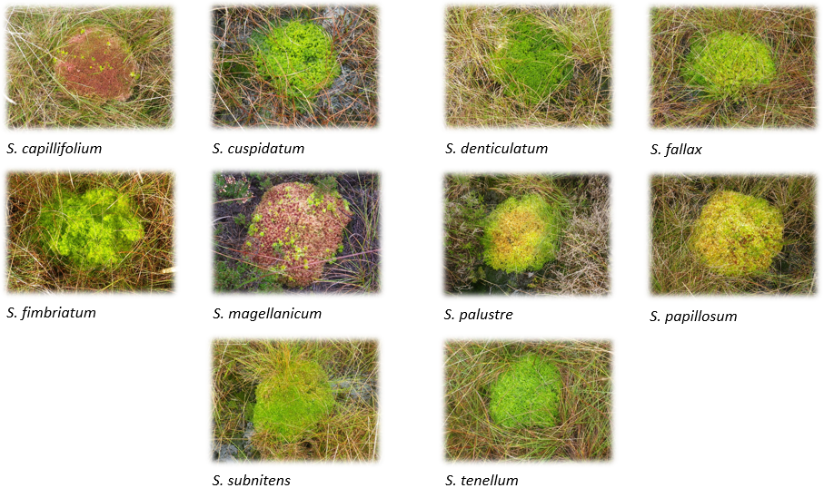
In one such experiment, we planted 11 different species of sphagnum with their precise locations input to ‘train’ the computer software to recognise the different species.
Final report - December 2021 Monitoring the impact of blanket bog conservation in the South Pennine Moors Special Are of Conservation using an unmanned aerial vehichl
Project update - June 2020 - Monitoring the impact of blanket bog conservation using aerial imagery
You may also be interested in...
UAV conservation practitioners guide, MoorLIFE 2020 | 2022
A conservation practitioner’s guide to the use of unmanned aerial vehicles (UAVs) for peatland monitoring and conservation
Monitoring the impact of blanket bog conservation using aerial imagery MoorLIFE 2020 | 2020
Using aerial imagery to monitor vegetation at a landscape scale, rather than the traditional site scale.
MoorLIFE 2020 Single species sphagnum report 2021
A report on techniques for planting sphagnum effectively
Funded by
![]()
![]()