Long-term monitoring of changes in plant species is providing evidence that our conservation techniques are working
Why we do it
Vegetation reveals a huge amount of information about the condition of moorland. Every different plant has its own place, its ‘niche’, and its presence tells us about the conditions there. By monitoring the vegetation we can recognise when conditions change, and link the changes we see to the work we have done.
What is moorland covered with?
Peak District and South Pennines moorlands are sometimes not covered at all! Without vegetation, the bare and exposed peat quickly erodes. Our top priority in these areas is re-vegetating bare peat to prevent it from being lost. Some moors can become dominated by single species (usually heather, purple moor grass or cotton grass.)
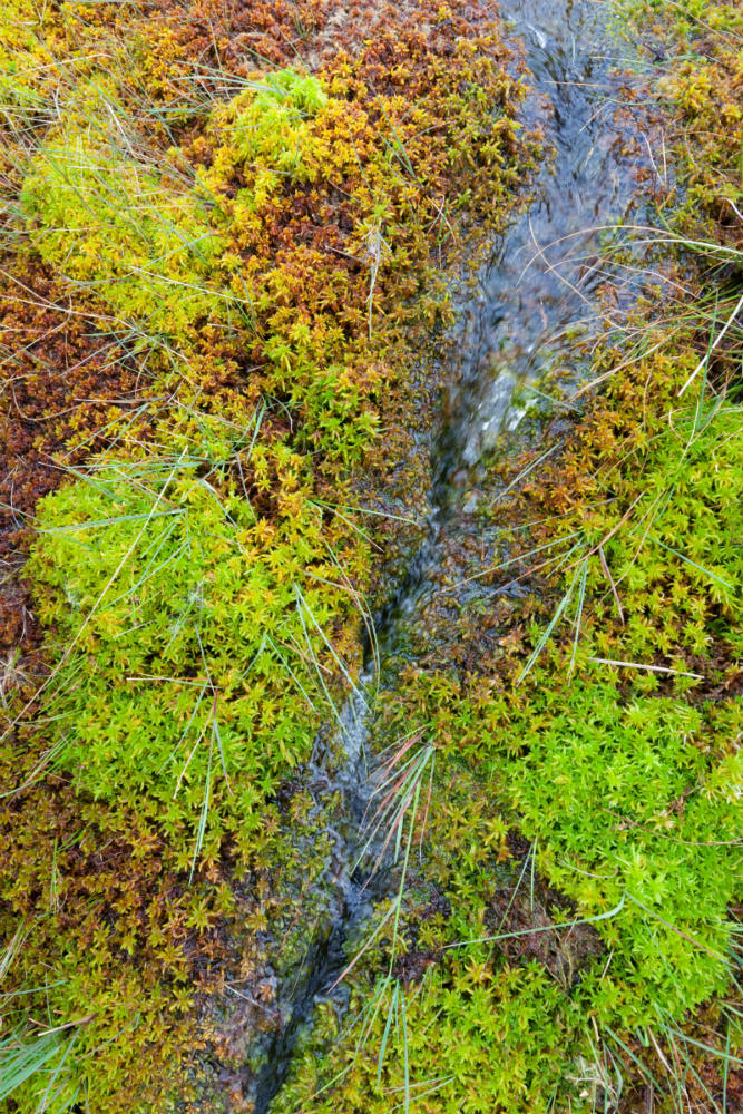
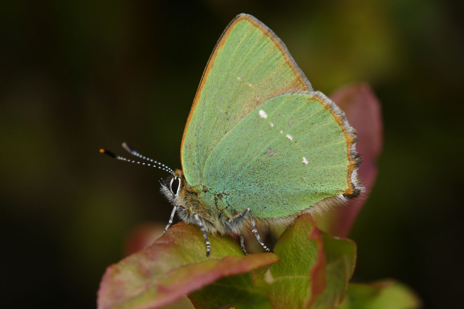
Healthy bog habitats are covered in a diverse community of specialist plants which in turn support a range of animals along with providing an array of other benefits.

Surveys and monitoring
We use a range of techniques including aerial photography using unmanned aerial vehicles and satellite imagery to gather data and monitor the presence of vegetation after our interventions. We use on-the-ground vegetation surveys to understand what type of vegetation is growing, the condition of the habitat and how it is changing.
What our monitoring shows
Monitoring of two sites over nine years (2003 to 2012) has provided evidence of the successful re-vegetation of bare peat using our peat stabilisation techniques. Monitoring has helped us understand how to re-establish native moorland plants successfully, including sphagnum moss, the key plant of active blanket bog.
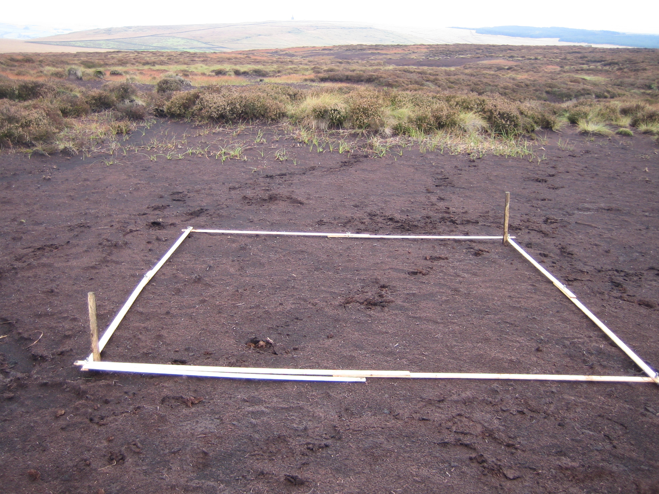
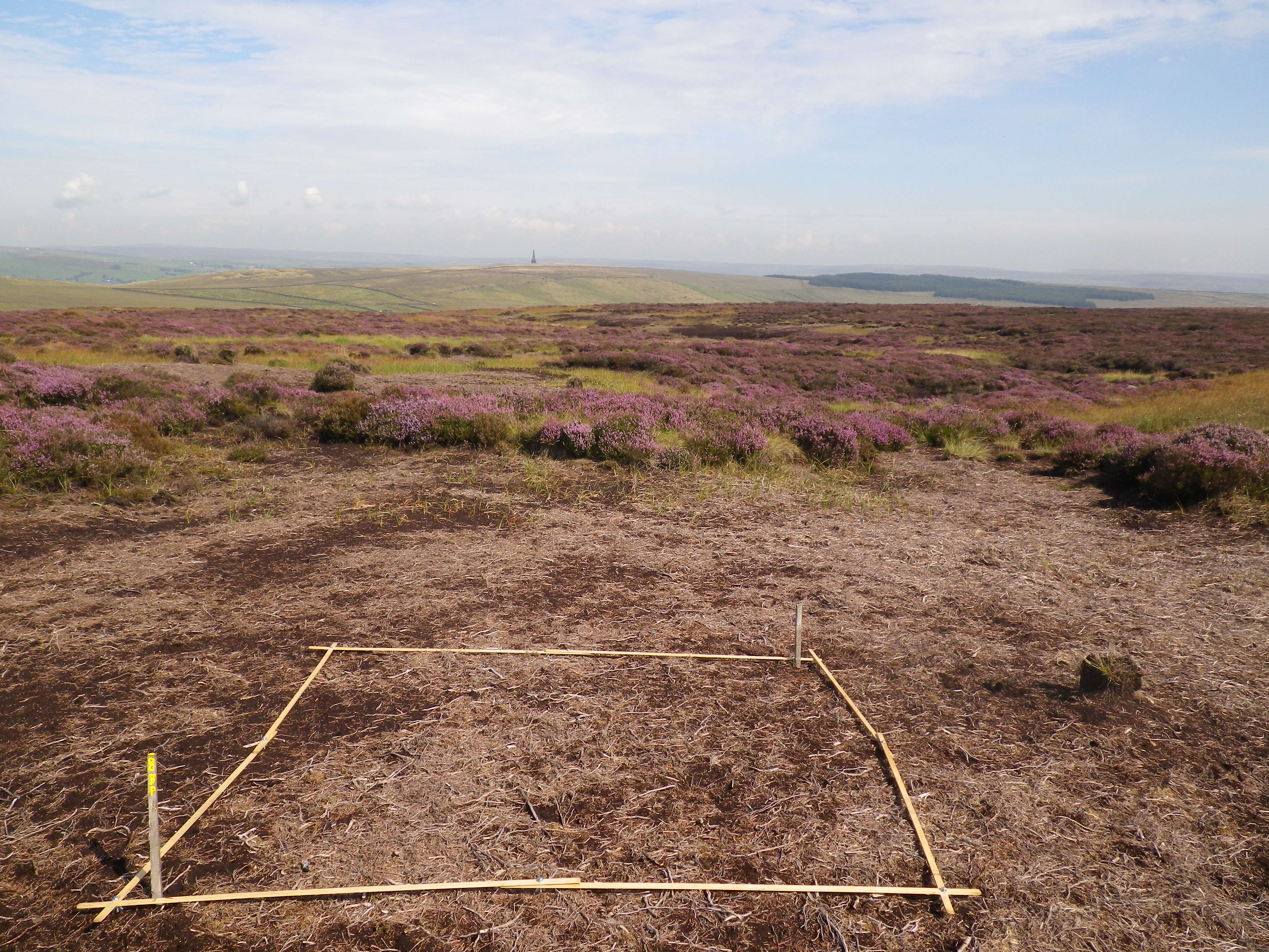
From bare to vegetated peat
Vegetation monitoring over time. The first photo of bare peat was taken in 2010 and the last photo was taken in 2014 - scroll through to see the transformation
Key facts and figures
Monitoring sites have been established to enable evaluation of methods of sphagnum establishment.
Establishment of grasses and moorland plants on restored sites reduced bare peat by 85% over four years (2010 to 2014).
Volunteers help with vegetation surveys every year. In 2017, around 20 volunteers gave 460 hours of their time to support project staff in gathering data from vegetation quadrats spread throughout the Peak District and South Pennines.
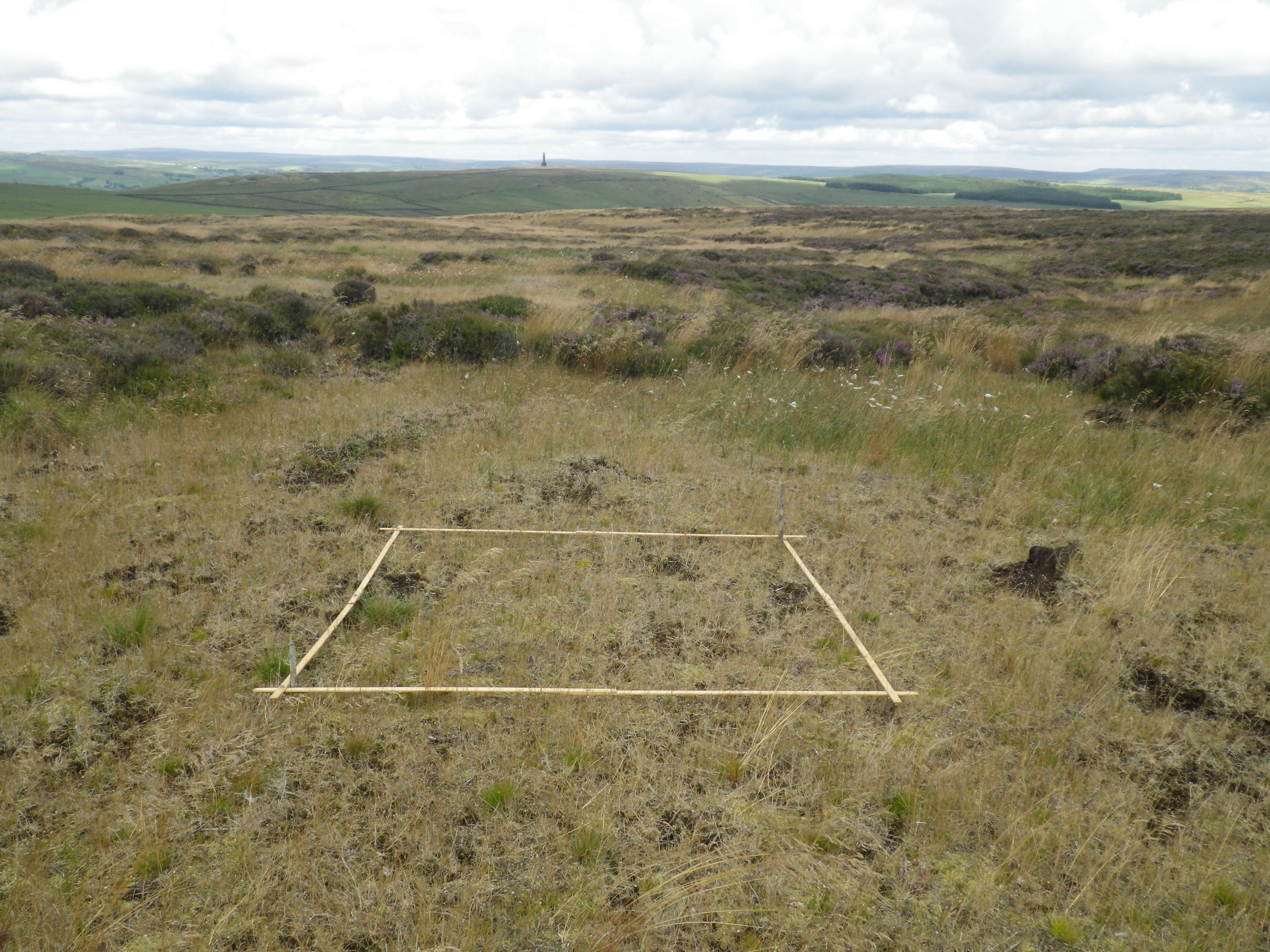
Through our annual vegetation surveys, we measure the changes in the moorland vegetation communities every year. These surveys have to take place after the bird nesting season so are completed during August and September. On our many monitoring sites we annually survey two-metre square monitoring plots (called quadrats) to identify the species of plants present, as well as their abundance.
By recording these figures year on year, we can document any changes that are happening. We do this on hundreds of quadrats throughout the moors; on bare peat, on intact blanket bog, and on areas where we have carried out conservation work. This then allows us to compare our treatments and find out where our work is most effective.
Help us compile a ‘Big Moss Map’. We need volunteers to record patches of sphagnum so that we can see whether there are changes in sphagnum occurrence over the years.
You may also be interested in...
Kinder Scout Sphagnum Trials Summary Peatland Restoration Project 2018
Comparing the establishment,survival and growth of four different sphagnum propagule types
Sphagnum Donor Site Monitoring Pilot Study Summary 2019
Study indicating that hummock forming species of sphagnum moss recover from harvesting from donor sites for translocation. Summary of report - shorter read